Our Weiser River Trail guide covers practical planning for Weiser River Trail Idaho — best time to visit, getting there, and what to do on the ground. We're here to cut through the noise and give you the essential details for an unforgettable trip along this historic rail-trail.
The Weiser River Trail Idaho is a true gem, an 84-mile (or 85.5 miles, depending on the source) National Recreation Trail that carves its way through the diverse landscapes of west-central Idaho. From the forested terrain near New Meadows to the high prairie and desert canyons leading to Weiser, this former railroad corridor offers an ever-changing panorama for hikers, bikers, and horseback riders alike.
Why Visit Weiser River Trail
The Weiser River Trail offers a unique blend of natural beauty, history, and outdoor recreation that sets it apart. We find the trail's transformation from the Pacific and Idaho Northern (P&IN) railway line, which operated from 1899 to 1995, into a public recreational path to be a remarkable feat of preservation.
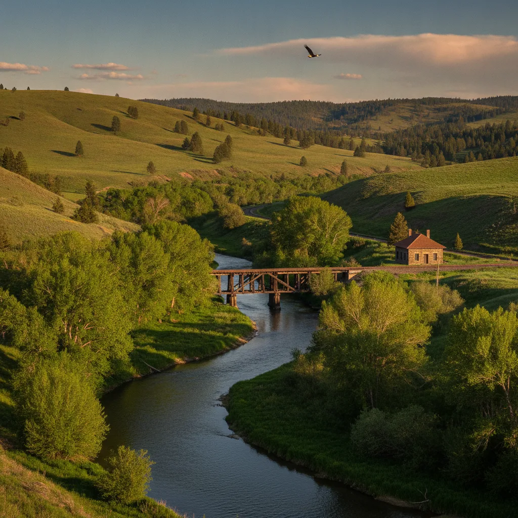
As you traverse the trail, you'll witness a spectacular shift in scenery, from the dense conifer forests and alpine meadows in the north to rolling hills, open canyons with black lava cliffs, and sagebrush-dotted semi-arid landscapes in the south.
Beyond the scenic vistas, the trail is a haven for wildlife. Our team has encountered reports of deer, elk, black bears, coyotes, wild turkeys, and a variety of birds including eagles, herons, and waterfowl. If you enjoy fishing, the Weiser River itself is home to rainbow trout, offering another delightful activity along the route.
The trail also boasts 62 historic rail trestles, providing glimpses into its past as a vital transportation network. The gentle, almost imperceptible downhill grade when traveling north to south makes for a more relaxed journey, especially for cyclists.
Who It's Best For
The Weiser River Trail is remarkably versatile, catering to a wide range of outdoor enthusiasts. We consider it ideal for:
- **Cyclists:** With its compacted gravel surface and gentle 2% downhill grade from north to south, it's perfect for mountain bikes, gravel bikes, or even sturdy hybrid bikes. Strong, experienced riders can tackle the entire 84 miles in a day, but a two-day trip is often recommended to truly savor the experience and allow for a stop at places like Mundo Hot Springs.
- **Hikers and Trail Runners:** The relatively easy grade and varied terrain make it an excellent choice for long-distance hiking or trail running. The Weiser River 50K Ultra and Relay, for example, utilizes a section of the trail from Council to Midvale, demonstrating its suitability for runners of all abilities.
- **Horseback Riders:** The trail is explicitly open to horseback riding, with facilities like corrals and water available at key trailheads such as Wye Campground.
- **Families:** We recommend the trail for kids over 8 years old, especially when tackling shorter sections. The numerous access points allow for customizable distances, making it manageable for various fitness levels.
- **Nature Lovers and Wildlife Enthusiasts:** The diverse ecosystems along the trail provide ample opportunities for birdwatching and spotting larger wildlife.
- **Winter Sports Enthusiasts:** In the winter months, the trail is also used by cross-country skiers and dog teams, offering year-round recreational opportunities.
Getting There & Parking
Accessing the Weiser River Trail is straightforward, with multiple entry points along its 84-mile length. We always advise checking the Friends of the Weiser River Trail website for the most current information on how to get to Weiser River Trail and available parking.
Weiser River Trail Access Points:
- Northern Terminus (near New Meadows/Rubicon): The northern end of the trail is officially about 8 miles from New Meadows. The easiest trailhead to find in this area is the Wye Campground, located north of the Tamarack Lumber Mill. This trailhead offers a large parking area, two corrals, campsites with hookups, tent sites, water, and a vault toilet.
- Council: In Council, you can access the trail by turning left on Hornet Creek Road when heading north on U.S. Route 95. There is also a gravel pull-out off Highway 95 where the trail leaves the highway and descends to the Weiser River.
- Cambridge: The most accessible parking in Cambridge is across Railroad Street from the Washington County Fairgrounds. This spot also features a kiosk with a map and picnic facilities.
- Midvale: The trailhead at Midvale is situated at a shady park with water and a porta-potty.
- Presley Trailhead: Located between Galloway Dam and Presley Bridge, this trailhead features a vaulted toilet, graded parking area suitable for horse trailers, and easy river access. Vehicle access is via Weiser River Road; turn east on Park Street from US 95 in Weiser, which becomes Weiser River Road.
- Southern Terminus (Weiser): The Weiser trailhead is located 0.3 miles west of U.S. Route 95 at E. Washington Street and E. 4th Street, just north of the Weiser Community Fishing Pond. Parking is available on Main Street, and the trailhead offers accessible restroom facilities, picnic tables, and a trail kiosk. The first mile from Highway 95 is paved, with plans for a horse path alongside it.
Weiser River Trail Parking:
Ample parking is available at various access points along the Weiser River Trail. We recommend utilizing the designated parking areas at the northern terminus (Wye Campground), Council, Cambridge (Washington County Fairgrounds), Presley Trailhead, and the southern terminus in Weiser. These locations often provide facilities such as restrooms, picnic areas, and kiosks with trail maps. For those with horse trailers, the Wye Campground and Presley Trailhead are particularly well-suited.
Keep in mind that while the trail is generally open year-round, sections may be wet or snow-covered, especially in the northern parts, so always check current conditions before heading out.
Top Things to Do
The Weiser River Trail offers a diverse array of activities, making it a fantastic destination for all types of outdoor enthusiasts. Our team has explored the best ways to experience this scenic corridor.
Weiser River Trail Hiking Trails
The Weiser River Trail is an exceptional destination for hiking, offering varied terrain and stunning views. The entire 84-mile (or 85.5-mile) length can be hiked, or you can choose shorter sections for a more leisurely stroll or a challenging day hike. The trail's surface is primarily compacted gravel, with some sections of ballast and paved portions through towns, making it generally easy to travel on foot. We particularly enjoy the forested sections in the north and the serene canyon stretches further south.
For a moderate hike, consider the section between Council and Cambridge, which is often cited for its scenic beauty, following the river through a mixed-use riparian area. The remote 20-mile stretch between Midvale and Presley in the canyon offers incredible views and a sense of wild isolation, though cell service may be limited here.
For those looking for a challenge, the Weiser River 50K Ultra and Relay takes place on a 31.07-mile section from Council to Midvale, showcasing the trail's suitability for longer distances. Remember to bring plenty of water, especially in exposed canyon sections.
Biking the Weiser River Trail
Biking is one of the most popular things to do at Weiser River Trail. The gentle downhill slope from the northern end near New Meadows to Weiser makes for an enjoyable ride, particularly for those looking for a less strenuous experience. Mountain bikes or bikes with at least 2-inch tires are recommended due to the gravel and sometimes rocky surface.
A full ride of the 84-mile trail can be done in a day by strong riders, but a two-day trip is ideal, allowing for exploration of the charming towns along the way and a relaxing stop at Mundo Hot Springs near Cambridge.
The Rubicon-Fruitvale section, an 18-mile stretch, is a favorite among cyclists for its fun and fast descent through a misty, forested canyon. The Friends of the Weiser River Trail also host a supported June Bike Event, offering 28-mile or 48-mile options, perfect for families.
Horseback Riding
The Weiser River Trail is very horse-friendly, with several trailheads equipped with corrals and ample parking for horse trailers. The Wye Campground at the northern end is an excellent starting point for equestrian adventures, offering dedicated facilities. The diverse landscapes make for varied and interesting rides.
Wildlife Viewing and Photography
The trail passes through a variety of habitats, providing excellent opportunities for wildlife viewing. We've noted the presence of deer, elk, bears, coyotes, and a wide array of birdlife, including raptors and waterfowl. Keep an eye out for sandhill cranes in the northern meadows during spring.
Fishing
The Weiser River runs alongside much of the trail, offering opportunities to cast a line for rainbow trout. Popular fishing spots include the Galloway Dam site in the Lower Canyon.
Exploring Local Towns and Hot Springs
The trail connects several small towns, including Weiser, Midvale, Cambridge, and Council, each offering amenities and a glimpse into local Idaho life. Mundo Hot Springs, located near Cambridge, is a popular stop for trail users to relax and rejuvenate.
Best Time to Visit
The Weiser River Trail offers different experiences depending on the season, though specific sections have optimal visiting windows.
- Spring (March-May): We consider spring an excellent time to visit, especially the southern end of the trail, which is typically accessible from March. The landscape is lush and green, with wildflowers blooming, particularly in the canyon sections. The Weiser River 50K Ultra and Relay often takes place in April, signaling good running conditions.
- Summer (June-August): The northern end of the trail is best enjoyed from May through October. Summer is popular for biking and hiking, but be prepared for heat and sun exposure, especially in the more open, southern sections and canyons. We advise carrying plenty of water and sunscreen. The Friends of the Weiser River Trail host a June Bike Event, which is family-friendly and supported.
- Fall (September-November): Fall brings vibrant colors to the cottonwoods and pines along the trail, making it a beautiful time for a visit. The southern end remains accessible until November. The October Trek, a fully supported event covering the entire trail from north to south, is a great way to experience the fall scenery.
- Winter (December-February): While less common, the trail is accessible year-round and can be used for cross-country skiing and dog sledding in winter, particularly in the northern, higher elevation areas. However, we recommend avoiding wet or snow-covered sections to protect the trail surface.
It's always a good idea to check the Friends of the Weiser River Trail website for current trail conditions and any specific closures, especially during spring runoff or after heavy snowfall.
Where to Stay Nearby
When planning your trip to the Weiser River Trail, our team understands that comfortable lodging is key to a great experience. While the trail itself offers some camping options, several nearby towns provide a range of accommodations. For the best Weiser River Trail lodging, we recommend looking into the communities of Weiser, Midvale, Cambridge, and Council.
Weiser
As the largest town at the southern terminus, Weiser offers the most extensive selection of lodging, including motels and restaurants. It's a convenient base for exploring the lower sections of the trail and enjoying local attractions like the Weiser Community Fishing Pond.
Midvale
Midvale, though smaller, still provides essential services including a grocery store, cafe, and a bed and breakfast. It's a good option for those looking to break up a longer journey or to access the scenic canyon sections of the trail.
Cambridge
Cambridge is approximately the halfway point of the trail and is home to Mundo Hot Springs, which offers a unique lodging experience alongside its popular soaking pools. Camping is also permitted at the Cambridge trailhead near the Washington County Fairgrounds, though it's adjacent to Highway 95.
Council
Council offers ample amenities and serves as a good rest stop or place to stock up on supplies. You can find RV parks and other lodging options here, making it a suitable base for exploring the northern and central parts of the trail.
Camping Along the Trail
For those who prefer to immerse themselves fully in nature, several commercial campgrounds are available along the trail. The Wye Campground, near the northern end, is a prime spot with nine campsites, three tent sites, power hookups, water, and horse corrals. Reservations for Wye Campground are recommended between May 15 and October 15 and can be made via email. Evergreen Campground, located off Highway 95 near Council, also provides access to the Weiser River Trail and offers reservable and first-come-first-serve sites, with a typical season from mid-May through mid-September.
Sample 2-Day Itinerary
To truly experience the breadth of the Weiser River Trail, our team recommends a multi-day adventure. This sample 2-day itinerary focuses on a north-to-south journey, taking advantage of the gentle downhill grade and allowing for a mix of activity and relaxation.
Day 1: Northern Forests to Canyon Views (Approx. 40-50 miles)
- Morning (New Meadows/Rubicon to Council): Begin your journey at the northern terminus near New Meadows (Rubicon). The Wye Campground trailhead is an excellent starting point, offering parking and facilities. The first section of the trail winds through conifer forests and along the upper Weiser River, featuring a fun and fast descent across multiple trestles. This part of the Weiser River Trail is particularly scenic. As you continue south, the landscape opens up, leading you towards Council.
- Lunch & Exploration (Council): Arrive in Council, a town with amenities where you can grab lunch and resupply. Take a moment to explore the local area before continuing your ride.
- Afternoon (Council to Cambridge): From Council, the trail continues through a beautiful open valley and then transitions into more canyon-like scenery. This section is often lauded for its picturesque views.
- Evening (Cambridge): Conclude your first day in Cambridge, roughly the halfway point of the trail. Check into your chosen Weiser River Trail lodging. We highly recommend a stop at Mundo Hot Springs to soak away the day's efforts. Enjoy dinner in town.
Day 2: Canyon to Prairie & Weiser (Approx. 34-44 miles)
- Morning (Cambridge to Midvale): After breakfast in Cambridge, resume your journey south. The trail from Cambridge to Midvale passes through open meadows along the banks of the Weiser River.
- Mid-day (Midvale to Presley Trailhead): This stretch of the trail takes you through a remote desert canyon, offering stunning views and a sense of solitude. Be prepared with sufficient water and snacks, as cell service can be limited. The Presley Trailhead, with its vaulted toilet and river access, makes for a good rest stop.
- Afternoon (Presley Trailhead to Weiser): As you leave the canyon, the landscape transitions to lush agricultural fields of alfalfa, onion, and canola. The final miles bring you into the town of Weiser.
- Evening (Weiser): Celebrate completing the Weiser River Trail in Weiser. Explore the historic downtown, visit the Weiser Community Fishing Pond, or if your timing aligns, experience one of the local events like the National Oldtime Fiddlers' Contest.
This itinerary is flexible; you can adjust distances based on your fitness level and interests. Remember to arrange for shuttle services if you're not doing an out-and-back trip. The Friends of the Weiser River Trail website often provides resources for shuttle and lodging.
Last updated: 2026-07-06 by the Roam States team.