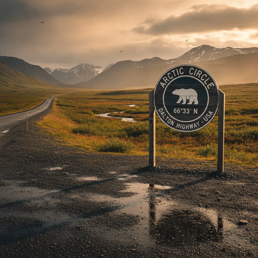
Our Arctic Circle Sign (Dalton Highway) guide covers practical planning for Arctic Circle Sign (Dalton Highway) Alaska — best time to visit, getting there, and what to do on the ground.
For many, the allure of Alaska’s vast, untamed wilderness culminates in a journey to the Arctic Circle. We, the Roam States editorial team, understand this deep-seated desire for adventure, which is why we’ve meticulously prepared this guide for visiting the iconic Arctic Circle Sign (Dalton Highway) Alaska. This landmark, situated at Milepost 115.2 on the legendary Dalton Highway, marks the geographic boundary of the Arctic Circle and offers an unparalleled photo opportunity for those venturing into the far north in 2026.
Why Visit Arctic Circle Sign (Dalton Highway)
Visiting the Arctic Circle Sign (Dalton Highway) is more than just a photo op; it's a profound accomplishment and a rite of passage for serious adventurers. We believe it represents the ultimate North American road trip, a chance to truly disconnect and immerse yourselves in one of the planet's last great wildernesses.
The Arctic Circle itself is an imaginary line at 66°33′N latitude, where, on the summer solstice, the sun doesn't set, and on the winter solstice, it doesn't rise. Standing at the sign, you're not just crossing a line on a map; you're entering a region of extreme natural phenomena and unparalleled solitude. The sense of achievement upon reaching this remote marker, knowing the challenging journey you've undertaken, is truly immeasurable. It's a testament to the adventurous spirit, offering a unique perspective on the sheer scale and raw beauty of Alaska.
Who It's Best For
This journey is tailor-made for the intrepid traveler, the seasoned road-tripper, and anyone with a deep appreciation for raw, untamed nature. If you thrive on self-sufficiency, embrace unpredictable conditions, and seek experiences far removed from typical tourist trails, then the Arctic Circle Sign (Dalton Highway) is calling your name. It’s ideal for photographers eager to capture dramatic landscapes and the unique light of the Arctic, wildlife enthusiasts hoping to spot caribou, muskox, or even grizzlies, and those simply looking to push their boundaries and achieve a significant travel milestone. While challenging, it can also be a memorable experience for families with older, adventurous children who understand the demands of remote travel.
Getting There & Parking
The journey to the Arctic Circle Sign (Dalton Highway) begins in Fairbanks, approximately a five-hour drive to the north. You'll start on the Elliott Highway before transitioning to the legendary Dalton Highway (Alaska Route 11), a 414-mile stretch of mostly gravel and dirt road that runs all the way to Deadhorse near the Arctic Ocean.
For those planning how to get to Arctic Circle Sign (Dalton Highway), it's crucial to understand that this is not a typical highway. It's primarily an industrial haul road, shared with massive 18-wheelers, which kick up significant dust in summer and navigate treacherous ice in winter. Road conditions are notoriously rough, with gravel, potholes, and steep grades. Many standard rental car companies prohibit driving on the Dalton Highway due to these conditions. We strongly recommend renting a high-clearance 4WD or AWD vehicle from specialized companies like GoNorth, Alaska 4x4 Rentals, Arctic Outfitters, or Alaska Auto Rental.
Preparation is paramount: carry at least one (preferably two) full-size spare tires, a heavy-duty tire plug kit, a portable air compressor, extra fuel, and an emergency kit with food, water, and warm clothes. Cell service is virtually nonexistent beyond Fairbanks, so a satellite communication device is highly recommended. A CB radio (Channel 19) is also essential for communicating with truckers.
The Arctic Circle Sign is located at Milepost 115.2, within the Arctic Circle Wayside, which serves as a rest stop and Bureau of Land Management-managed campground. Regarding Arctic Circle Sign (Dalton Highway) parking, there are pull-offs at the wayside to accommodate visitors. There are also outhouses available at this location. No specific fees are charged for visiting the sign itself in 2026. As of April 2026, there are no seasonal vehicle weight restrictions on the Dalton Highway.
Top Things to Do
Our team believes that the journey along the Dalton Highway is as much a destination as the sign itself. Here are our top things to do at Arctic Circle Sign (Dalton Highway) and along this legendary route:
- Photo Opportunity at the Sign: Naturally, the primary draw is capturing that iconic shot at the Arctic Circle Sign (Dalton Highway). It’s a memorable bucket-list moment, signifying your entry into the Arctic. Take your time, get creative, and don't forget to check out the back of the sign, which often features stickers from previous visitors.
- Receive Your Arctic Circle Certificate: Many tours offer an official "Cross the Arctic Circle" certificate to commemorate your achievement. If driving independently, you can obtain one by showing a photo at the Morris Thompson Cultural and Visitor's Center in Fairbanks.
- Explore the Arctic Circle Wayside: This pull-off at Milepost 115.2 not only hosts the sign but also offers basic amenities like pit toilets and is a designated campground. It's a great spot to stretch your legs and soak in the remote surroundings.
- Witness the Midnight Sun or Northern Lights: Depending on the season, you can experience the surreal phenomena of the midnight sun (late May to mid-July) or the mesmerizing aurora borealis (late August through March). The Arctic Circle Campground at Mile 115 is an excellent spot to experience the midnight sun in summer. For aurora viewing, Coldfoot and Wiseman are prime locations, especially from September to March.
- Drive the Dalton Highway: The drive itself is an adventure. Among the top things to do in Dalton Highway is simply experiencing the vast, remote Alaskan wilderness, from boreal forests to tundra. You'll parallel the Trans-Alaska Pipeline for much of the way, offering unique photographic opportunities.
- Visit Yukon River Camp (Mile 56): This is a crucial stop for fuel, snacks, and a meal. It's located just past the Yukon River Bridge, the only vehicle-carrying bridge across the mighty Yukon in Alaska. We highly recommend trying a salmon burger here.
- Stop at Finger Mountain (Mile 98): Stretch your legs and explore the unique rock formations. There are also outhouses here. The Finger Mountain Interpretive Trail is a short, scenic hike worth the stop.
- Explore Coldfoot Camp (Mile 175): Known as the "world's northernmost truck stop," Coldfoot offers fuel, lodging, a 24-hour restaurant, and minor tire repairs. It's a hub for Arctic exploration and home to the Arctic Interagency Visitor Center.
- Arctic Interagency Visitor Center in Coldfoot: Located across from Coldfoot Camp, this center provides invaluable information on the Arctic region's flora, fauna, human history, and recreational opportunities. They offer exhibits, nature trails, and evening programs.
- Visit Wiseman (Mile 188): A small, historic mining community north of Coldfoot, Wiseman offers a glimpse into traditional Arctic life and often has opportunities for aurora viewing.
- Cross Atigun Pass (Mile 245): This is the highest pass in Alaska, at 4,800 feet, offering breathtaking views of the Brooks Range.
Remember, the Dalton Highway demands respect and thorough preparation. Always be self-sufficient and aware of your surroundings.
Best Time to Visit
The best time to visit the Arctic Circle Sign (Dalton Highway) largely depends on what kind of experience you're seeking. Our team generally recommends late spring through early fall for most travelers, specifically June to August, when road conditions are typically best.
- Summer (June to Mid-July): This is prime time for experiencing the "midnight sun," where the sun remains above the horizon for 24 hours. Wildflowers are in bloom, and caribou congregate along the coastal plain. However, be prepared for mosquitoes, which can be intense, especially on calm days and in wetland areas. Temperatures in early July 2026 are expected to be in the upper 60s to lower 70s during the day around the Dalton Highway summits, with lows around 50°F.
- Late Summer/Early Fall (Mid-August to September): This period offers a beautiful transition. Mid-August brings cooler days, frosty nights, and brilliant fall colors, particularly in the Brooks Range and south of the Yukon River. It's also an excellent time for wildlife viewing. Critically, late August marks the beginning of the aurora borealis viewing season, with September being ideal due to a good balance of darkness and more comfortable temperatures.
- Winter (October to May): For the truly adventurous, winter offers a stark, snowy beauty and the best chance to witness the spectacular Northern Lights. However, conditions are extreme, with temperatures frequently dropping below -30°F, and limited daylight or even polar night near the winter solstice. Driving can be treacherous due to ice and heavy snow. If you're planning a winter trip, consider a guided tour.
Regardless of the season, check current road conditions via 511.alaska.gov before you depart, as conditions can change rapidly.
Where to Stay Nearby
When planning your visit to the Arctic Circle Sign (Dalton Highway) lodging options are extremely limited and rustic, reflecting the remote nature of the region. We emphasize the need to book well in advance, especially during the peak summer months.
Here are the primary options for Arctic Circle Sign (Dalton Highway) lodging:
- Arctic Circle Campground (Mile 115): Located just slightly off the main highway, this Bureau of Land Management campground is near the Arctic Circle Sign itself. It offers basic amenities like pit toilets and bear-proof trash cans. Camping here allows you to experience the midnight sun during summer.
- Yukon River Camp (Mile 56): Situated at the Yukon River Bridge, this camp offers basic and clean motel-style rooms, though many have shared bathrooms. It also provides fuel, a restaurant, and a marketplace. The restaurant operates from 9 AM to 10 PM in summer, with shorter winter hours.
- Coldfoot Camp (Mile 175): This is the most developed stop along the Dalton Highway, approximately 60 miles north of the Arctic Circle Sign. The Inn at Coldfoot Camp offers cozy, clean rooms, each with two twin beds and a private bathroom with a shower—a luxury in this remote area. Rates for 2026 are $269 per night for single or double occupancy, subject to change. Coldfoot Camp also provides fuel, a 24-hour café, a post office, a gift shop, and tire repair services. Free camping is also available during summer months; inquire at the front desk. Showers can be purchased for $14 per person.
- Marion Creek Campground (Mile 180): Five miles north of Coldfoot, this is the most developed campground on the Dalton Highway, featuring 27 sites, a summer host, potable water, and well-maintained outhouses.
- Wiseman (Mile 188): A small, historic village a short drive from Coldfoot, Wiseman offers a few independent lodging options, often rustic cabins or guesthouses. These provide a more intimate, local experience.
Beyond these, options are virtually nonexistent. For those continuing further north, Deadhorse (Mile 414) offers Deadhorse Camp, which provides accommodations for visitors venturing to Prudhoe Bay.
Sample 2-Day Itinerary
To truly experience the Arctic Circle Sign (Dalton Highway) and its surroundings, we recommend at least a two-day itinerary from Fairbanks. This allows for a more relaxed pace and greater opportunities for exploration and wildlife viewing.
Day 1: Fairbanks to Coldfoot via the Arctic Circle
- Morning (8:00 AM): Depart Fairbanks. Ensure your vehicle is fully fueled, stocked with extra gas, water, snacks, and emergency supplies. Drive north on the Elliott Highway, transitioning to the Dalton Highway.
- Late Morning (11:00 AM): Arrive at Yukon River Camp (Mile 56). Fuel up, grab a snack, and take photos of the Trans-Alaska Pipeline crossing the Yukon River. Consider a salmon burger for lunch.
- Early Afternoon (1:00 PM): Continue north. Stop at Finger Mountain (Mile 98) for a short walk and to stretch your legs.
- Mid-Afternoon (2:30 PM): Reach the Arctic Circle Sign (Dalton Highway) Alaska (Mile 115.2). Spend ample time here for photos, exploring the wayside, and soaking in the accomplishment. Obtain your Arctic Circle Certificate if on a tour.
- Late Afternoon (4:00 PM): Continue driving north to Coldfoot Camp (Mile 175). Check into your pre-booked accommodation at the Inn at Coldfoot Camp.
- Evening: Enjoy dinner at the 24-hour café at Coldfoot Camp. Visit the Arctic Interagency Visitor Center to learn more about the region and attend any evening programs. If visiting in late summer or winter, keep an eye out for the Northern Lights.
Day 2: Explore Coldfoot & Return to Fairbanks
- Morning: Enjoy breakfast at Coldfoot Camp. Consider an optional excursion, such as a flightseeing tour over the Brooks Range or a visit to the nearby historic village of Wiseman. Alternatively, explore the nature trails around Coldfoot.
- Late Morning: Begin your southbound journey on the Dalton Highway. Take your time, stopping at any overlooks or points of interest you may have missed on the way up.
- Afternoon: Enjoy the scenic drive. Stop for lunch at Yukon River Camp again or pack a picnic to enjoy at one of the many pull-offs.
- Late Afternoon/Evening: Continue back to Fairbanks, arriving by early evening.
This itinerary is flexible; you can extend your stay in Coldfoot to explore Gates of the Arctic National Park or the Arctic National Wildlife Refuge (though these require significant planning and often bush plane access).
Is It Worth Visiting?
We unequivocally believe that the Arctic Circle Sign (Dalton Highway) is worth visiting. While it’s a long journey on a challenging road, the rewards far outweigh the effort. For those wondering, "is Arctic Circle Sign (Dalton Highway) worth visiting?" our answer is a resounding yes, especially for travelers seeking a truly unique and transformative Alaskan experience.
The sense of accomplishment from traversing the rugged Dalton Highway and standing at this iconic marker is profound. It’s a journey into a landscape that few ever see, an opportunity to witness extreme natural phenomena like the midnight sun or the aurora borealis, and a chance to connect with the raw power of the Arctic wilderness. The remote nature of the trip, the limited services, and the challenging road conditions demand preparation and self-reliance, but these very elements contribute to the unforgettable adventure. We encourage any traveler with an adventurous spirit to consider this incredible journey to the Arctic Circle Sign (Dalton Highway).
FAQ Longtails
Arctic Circle Sign (Dalton Highway) with kids
Visiting the Arctic Circle Sign (Dalton Highway) with kids is certainly an adventure, but it requires careful planning. We recommend it for older, more resilient children who can handle long stretches in a vehicle and understand the remote nature of the trip. Pack plenty of entertainment, snacks, and be prepared for limited amenities. The Arctic Interagency Visitor Center in Coldfoot offers educational exhibits, and the chance to spot wildlife along the Dalton Highway can be exciting for children.
best hotels near Arctic Circle Sign (Dalton Highway)
The "best" hotels near the Arctic Circle Sign (Dalton Highway) are relative to the extremely remote environment. The most comfortable and well-equipped lodging is at Coldfoot Camp (Mile 175), offering private bathrooms and a 24-hour restaurant. Closer to the sign, Yukon River Camp (Mile 56) provides basic motel rooms, some with shared baths. For those seeking a true wilderness experience, the Arctic Circle Campground (Mile 115) is right by the sign, offering primitive camping.
Arctic Circle Sign (Dalton Highway) tips
Our top tips for visiting the Arctic Circle Sign (Dalton Highway) include: drive a high-clearance 4WD/AWD vehicle, carry at least two full-size spare tires and a repair kit, pack extra fuel, food, water, and emergency supplies. Inform someone of your travel plans as cell service is non-existent. Drive defensively, be aware of large trucks, and consider a CB radio. Finally, bring industrial-strength insect repellent in summer.
where to stay near Arctic Circle Sign (Dalton Highway)
Near the Arctic Circle Sign (Dalton Highway), your primary options are the Arctic Circle Campground (Mile 115) for primitive camping, Yukon River Camp (Mile 56) for basic motel rooms and services, and Coldfoot Camp (Mile 175) for more developed lodging with private baths and a restaurant. We strongly advise making reservations well in advance for any indoor accommodations.
Arctic Circle Sign (Dalton Highway) parking
Parking at the Arctic Circle Sign (Dalton Highway) is available at the Arctic Circle Wayside, located at Milepost 115.2. This pull-off area is designed to accommodate visitors and provides space for vehicles to park while you take photos and explore the immediate area. There are no specific fees for parking at the sign itself.
best time to visit Arctic Circle Sign (Dalton Highway)
The best time to visit the Arctic Circle Sign (Dalton Highway) for most travelers is from June to August for better road conditions and the midnight sun. For Northern Lights viewing, late August through March is ideal, with September and March offering a balance of darkness and more moderate temperatures. Always check current road conditions before your trip.
Our team at Roam States has collectively ventured across countless miles of American wilderness, but few experiences rival the raw, untamed beauty of the Dalton Highway and the profound sense of achievement that comes with reaching the Arctic Circle Sign. This isn't a trip for the faint of heart, nor for those seeking luxury. It's an expedition into the very soul of Alaska, demanding respect, preparation, and an unyielding spirit of adventure. We encourage you to embrace the challenge, for the memories forged on this journey will undoubtedly last a lifetime. Don't forget to explore other incredible Alaskan destinations like Denali National Park & Preserve, Kenai Fjords National Park, and to consult our comprehensive guide to the Best places in Alaska for further inspiration.
Last updated: 2026-07-05 by the Roam States team.